

![]()
Die Hauptfunktionen:
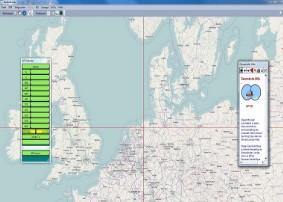
Chart formats: OpenSeaMap, OpenStreetMap, WSV, BingMaps, ENC, BSD and even scanned maps.
Evaluation of the data sent by the GPS.
Send Waypoints to create routes to GPS.
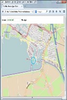
Representation of your position on a moving map.
AIS. Representation of the position of foreign ships.
Set of waypoints via mouse click.
Navigational tasks.
Built-in NMEA simulator.
Plotting (in conjunction with logbook).
Autopilot control.
![]() Free of charge:
Free of charge:
GPS-32 is absolutely free when used with tiles from OpenSeaMap and OpenStreetMap.
![]()
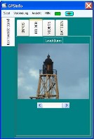
GPSInfo is a program with which you can store your own information to a GPS position. With connected GPS, or in connection with GPS-32 your files will be displayed when reaching this position.
![]()
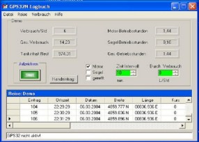
Perform a fully automated logbook. Let's calculate the fuel consumption on the log. In connection with the module logbook view a recording of the distance traveled.
A free for registered users module to GPS-32.
![]()
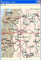
Receives a broadcast from GPS-32 screenshot.
Position is indicated by crosshairs. Data transfer over the network. Ideal for display on the control booth monitor.
For Windows operating system.
A free for registered users module to GPS-32.
![]()
Receives a broadcast from GPS-32 screenshot.
Position is indicated by symbol. Data transfer over the network. Ideal for display on mobilr phone or tablet.
For all operating systems.
A free for registered users module to GPS-32.